Thomas Sandby (1721-98)
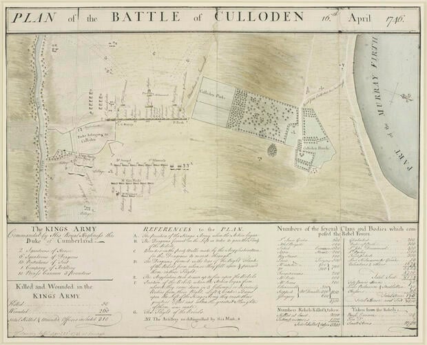
Map of the Battle of Culloden, 1746 (Culloden Moor, Highland Region, Scotland, UK) 57°28'00"N 04°05'00"W dated 23 April 1746
RCIN 730028
This plan, made seven days after the engagement, shows the Jacobite forces ranged between the walls of Culloden Park on the right and the Culwhiniac Parks on the left. These walls provided protection for the Jacobites yet restricted their movement. The government forces are ranged opposite, in the formation decided upon in the Duke of Cumberland’s plan (displayed nearby). Sandby shows the action of General Bland (marked ‘D’): a brigade of government cavalry breached the walls in order to attack the enemy’s right flank from behind. The retreat of the Jacobite survivors is shown at the top (marked ‘G’). Other events are described in the text below.
Archaeological excavations have shown the accuracy of this drawing, which was probably commissioned by the Duke of Cumberland.
King’s Military Map Collection
Cat. 62
