-
1 of 253523 objects
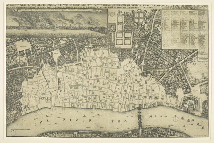
London after the Fire dated 1667
Etching | 53.8 x 82.3 cm (whole object) | RCIN 805286

Wenceslaus Hollar (1607-77)
London after the Fire dated 1667
-
The left half of an etched map of London, after the Great Fire: the print combines a panoramic view of the burning city, as seen from Southwark on the South Bank, with a map of the devastated city from Temple in the west to the Tower in the east, on a scale of about 1:3170. A key of 170 landmarks and 25 wards is included at upper right, along with statistics of the destruction. The lower left corner has been repaired and the etched lines recreated in pen and ink. Second state of two. For the right side of the map, see RCIN 805287.
The Great Fire of London broke out on Sunday 2 September 1666 and raged for three days destroying most of the City of London. Just five days later the king ordered Wenceslaus Hollar and Francis Sandford 'to take an exact plan and survey of the city, as it now stands after the calamity of the late fire'. The result was a small map (RCIN 802851), published by November 1666. Around 1660 Hollar had undertaken to produce a monumental bird's-eye view of London, '10 foot in breadth, and 5 foot upward'. Despite the king's orders, the project fell into abeyance, and only two impressions of one of the estimated 24 sections are known. Instead Hollar prepared this larger, improved version of the first Fire map, published in 1667 (with a second state, as here, issued in 1669). Hollar's maps of post-fire London were used by those tasked with rebuilding the city, such as John Evelyn, who remarked: 'I have since lighted upon Mr. Hollar's late Plan, which looking upon as the most accurate hitherto, has caus'd me something to alter what I had so crudely don'.
Text adapted from Charles II: Art & Power, London, 2017Provenance
Royal Collection by 1818
-
Creator(s)
(print seller) -
Medium and techniques
Etching
Measurements
53.8 x 82.3 cm (whole object)
Category
Object type(s)
Alternative title(s)
AN EXACT SVRVEIGH OF THE STREETS LANES AND CHVRCHES CONTAINED WITHIN THE RVINES OF THE CITY OF LONDON FIRST DESCRIBED IN SIX PLATS BY IOHN LEAKE, IOHN / IENNINGS, WILLLIAM MARR, WILL.m LEYBVRN, THOMAS STREETS & RICHARD SHORTGRAVE in Dec.ber A.o 1666. BY THE ORDER OF THE LORD MAYOR ALDERMAN AND COMMON COVNCELL OF THE SAID CITY.
London after the Fire: on 2 plates (a) on left, (b) on right [805287].