-
1 of 253523 objects
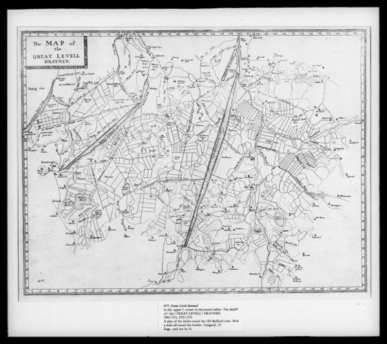
Previously attributed to Wenceslaus Hollar (1607-77)
Map of Great Level drained published 1662 or 1772
RCIN 802515

Previously attributed to Wenceslaus Hollar (1607-77)
Map of Great Level drained published 1662 or 1772
-
Plan of dykes round the Old Bedford river. With a scale all round border. Not by Hollar. Plat to Dugdale's The History of Imbanking & Drayning of Divers Fenns & Marshes
-
Creator(s)
-
Medium and techniques
Category