-
1 of 253523 objects
John Bower (fl.1853)
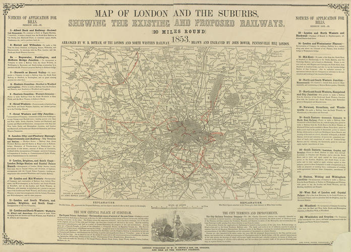
Map of London and the surburbs shewing the existing and proposed railways (20 miles around). c.1853
RCIN 702196

John Bower (fl.1853)
Map of London and the surburbs shewing the existing and proposed railways (20 miles around) c.1853
-
Map of London, Surrey, Middlesex, Essex, Kent, Berkshire, Buckinghamshire and Hertfordshire. Red lines marking new railways lines. Key and explanations on either sides.
-
Creator(s)
(engraver) -
Medium and techniques