-
1 of 253523 objects
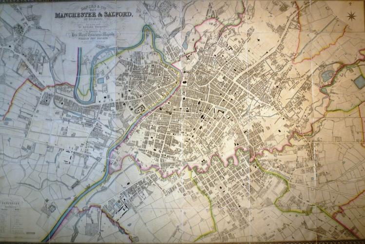
Bancks & Co's plan of Manchester & Salford, with their environs ... from an actual survey by Richard Thornton. 1831
34.5 x 3.0 cm (whole object) | RCIN 1075370

Thornton, Richard
Bancks & Co's plan of Manchester & Salford, with their environs . . . from an actual survey by Richard Thornton 1831
-
This finely produced map, commissioned from a survey done by Richard Thornton in 1831, provides a glimpse into the appearance of the towns of Manchester and Salford immediately prior to their dramatic growth during the Industrial Revolution.
Large parts of the map are taken up by fields, most notably at Hulme and Ardwick where the medieval village street plans are still visible. Within twenty years, the majority of this area was built-up with new factories, cotton mills and slums as the population swelled due to immigration from all parts of the British Isles.
This map was likely presented to William IV in 1831.
Provenance
Likely presented to William IV
-
Creator(s)
(cartographer)(publisher)(engraver)Acquirer(s)
-
Measurements
34.5 x 3.0 cm (whole object)
32.0 x 22.0 cm (whole object)
126.0 x 190.0 cm (whole object)